This area between Leeds city centre and the M1 and beyond is referred to as Aire Valley Leeds. It contains over 400 hectares of development land which can help meet Leeds' need for housing and provide new jobs.
Adoption of the AVL AAP
The AVL AAP was adopted by Leeds City Council on 8 November 2017 having been found sound by the inspector appointed to oversee the public examination process, subject to the inclusion of the main modifications set out in the Appendix 1 to her report.
The AVL AAP now forms part of the Development Plan and will be used in determining planning applications within the Plan boundary area alongside the Leeds Core Strategy and Natural Resources and Waste Local Plan and the remaining UDP ‘saved’ policies. Appendix 1 of the AVL AAP sets out a list of the policies which have been replaced by those contained within the AVL AAP.
The following documents are available:
- Adopted AVL AAP(PDF 1.5MB)
- AVL AAP Map Book(PDF 22MB)
- Plans Illustrating the Policies Map Inset(PDF 1.7MB)
- Adoption Statement(PDF 58KB)
- Sustainability Appraisal Adoption Statement(PDF 162KB)
- Sustainability Appraisal and addendums to the Sustainability Appraisal(PDF 12MB)
- The Inspector’s Report and Main Modifications(PDF 681KB)
- Boundary Plan(PDF 1.2MB)
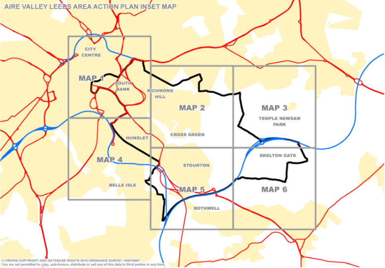
AVL AAP inset map
The Aire Valley Leeds Area Action Plan inset map is split into six map sheets as illustrated on the map below.
View the individual map sheets by clicking on the numbered squares on the map. These should be viewed alongside the Map Key (PDF 0.6MB) and policies maps.
Further information
If you require any further details on the AVL AAP, please contact us at avlaap@leeds.gov.uk.